Utility and infrastructure GIS
I map utility lines, inventory assets, and connect records to the map for small municipal utilities and rural electric systems. The people who run the system have to be able to use the result and keep it current.
Corban Garcia, GISP — GIS Analyst
I build GIS, maps, and practical data tools for utilities, water, land, and rural operations in southwest Kansas.
I make maps, tools, and research about utilities, water, and land in southwest Kansas.
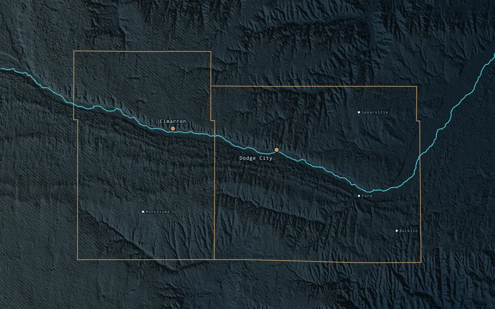
High Plains GIS is the portfolio of Corban Garcia, GISP, a GIS analyst based in Cimarron, Kansas. The work includes utility mapping, water and wastewater infrastructure, CAD-to-GIS conversion, asset-management workflows, and planning-scale spatial analysis.
The ground here is flat, the roads follow section lines, and the Ogallala Aquifer is under pressure. Most of the projects on this site deal with at least one of those conditions.
About meAreas of focus
Utility, environmental, and economic questions often appear in the same project. The work is grouped into three areas so it is easier to browse.
I map utility lines, inventory assets, and connect records to the map for small municipal utilities and rural electric systems. The people who run the system have to be able to use the result and keep it current.
I work on Ogallala Aquifer questions, land-use suitability analysis, and remote sensing and change detection. Most of it supports long-range decisions in a semi-arid region where water is the limiting factor.
I build present-worth cost-benefit comparisons and MCDA suitability models. The output is a score, a map, and a short written finding that a board can question and still act on.
Selected work
One study, two public maps, and three tools. Each one opens in the browser.
All work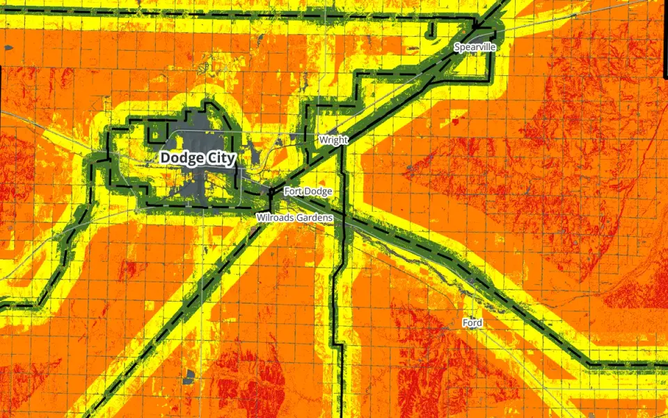
A county-scale solar siting suitability study for Ford County. I weighted four factors, ran five weighting scenarios, and found that the answer depends heavily on transmission access.
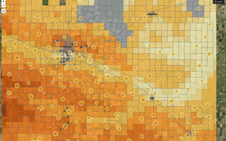
A public reference map of Ford County groundwater. It shows mapped depth-to-water ranges, active WIMAS diversion points, monitoring well references, and Dodge public-water wells.
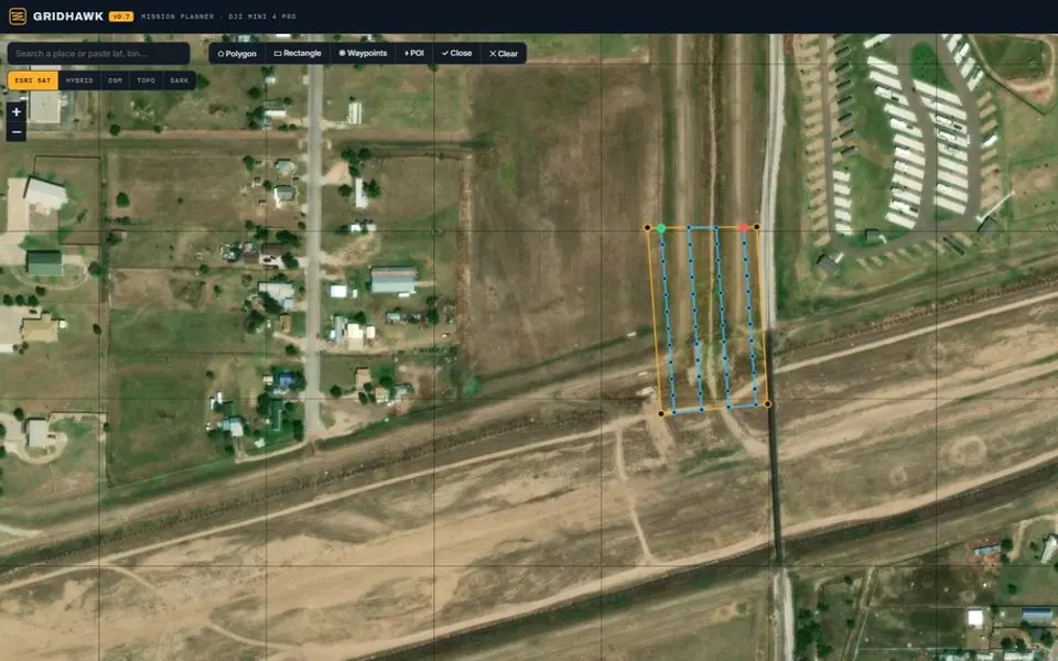
A browser-based mission planner for DJI Mini 4 Pro mapping flights. Define a survey area over imagery to generate a flight grid, camera-based spacing, altitude, overlap, and waypoints.
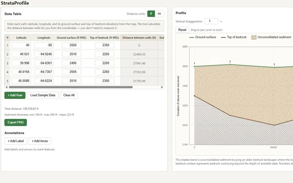
A browser tool that converts well-location and elevation records into a geologic cross-section. It calculates well spacing and sediment thickness while displaying the profile and source values together.
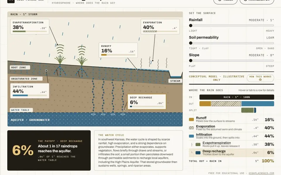
A conceptual hydrology teaching tool that shows how rainfall is partitioned among runoff, evaporation, and infiltration under different soil and slope conditions. It is an illustrative model, not a site-calibrated analysis.
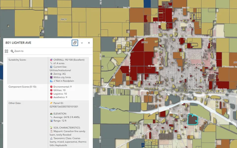
An MCDA suitability score for residential parcels around Dodge City. Environmental constraints, utility access, logistics, and aesthetics are weighted into one score from 0 to 100 for each parcel.
Public map + assistant
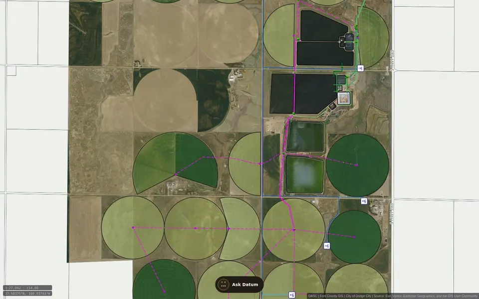
Datum is a public, read-only reference map for Dodge City and Ford County. It organizes selected published water, sewer, well, hydrant, and related GIS layers for browsing and planning. Layers are added as data is generated.
Graduate research · MSU LRES
My coursework at Montana State builds toward one capstone question. Could Dodge City keep some of its stormwater and send it back to the aquifer?
Research overviewFor the final project I studied solar siting suitability in Ford County. I combined transmission proximity, land cover, slope, and road proximity in a weighted MCDA overlay and tested it across five weighting scenarios.
Read the studyThis course covers runoff, infiltration, and aquifer recharge, and it puts a lot of weight on explaining Earth systems to other people. I am using it to work out how to explain the capstone to people who do not work in GIS or hydrology.
My term project lays groundwork for the capstone. It uses the EPA four-step risk framework to screen urban-runoff pathways, potential recharge, and groundwater receptors.
This course covers watershed hydrology and how it relates to water quality and water quantity. Topics include how water inputs and outputs are measured, how human changes to a watershed affect surface and groundwater flow, and how to find and work with online water data. It is written for science teachers, so students also build lesson plans.
Why I am taking it. The capstone depends on how a town changes the path of its runoff, and this course covers that subject directly.
This course builds quantitative analysis and modeling skills in watershed and environmental science. Students learn to describe how a model works, judge models of different types and complexity, and write code to analyze and simulate watershed processes.
Why I am taking it. A feasibility screen is a model, and I will need to be able to defend how mine is built.
This course covers the biological and non-biological processes in the soil ecosystem, with more weight on the biological ones. It includes nutrient and carbon cycling and the effects of human activity and disturbance on how soil functions.
Why I am taking it. Recharge water has to pass through soil before it reaches an aquifer.
This course covers the basics of remote sensing so that students can read its environmental applications critically. It combines textbook and journal readings, online discussion, and hands-on exercises in digital image processing and analysis.
Why I am taking it. I expect to use imagery for land cover and surface conditions in the capstone.
This course examines the major natural resource laws, with an emphasis on the federal model. It uses case studies to review the legislation and court cases that govern water, minerals, timber, range, wildlife, recreation, and wilderness.
Why I am taking it. Capturing and recharging water raises legal questions that a GIS screen cannot answer. I want to know what those questions are before I write the paper.
This course covers the physical, biological, and chemical fundamentals of water quality along with the policy and management side. Topics include the legal framework for water quality management in the United States, calculating concentrations and loads, and the pitfalls of monitoring individual parameters.
Why I am taking it. Stormwater carries whatever is on the street. Water quality is one of the open questions in the capstone.
Dodge City routes stormwater to the Arkansas River while the Ogallala Aquifer remains under pressure. My capstone asks whether a portion of that runoff could be captured, retained locally, and routed by gravity to locations suitable for further recharge evaluation.
Where it standsTools & lab
AppAppAppA live illustration and a balanced budget table for any combination of inputs.
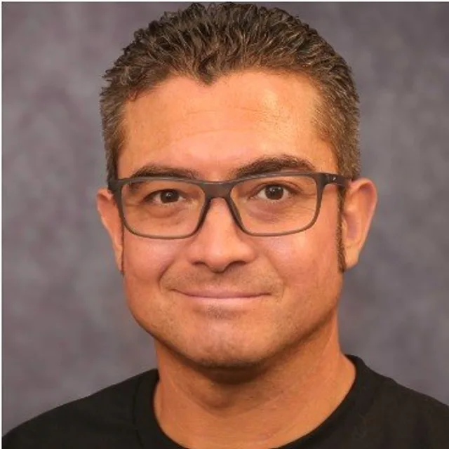
Corban Garcia, GISP
About & résumé
I work in infrastructure GIS where utilities, water, land, and rural operations overlap. My work includes electric-system mapping, water, wastewater, and stormwater infrastructure, CAD-to-GIS conversion, asset-management and field-collection workflows, and planning-scale analysis.
I am a GISP, a Class 4 KDHE-licensed water operator, and an FAA Part 107 remote pilot. I am also a graduate student in Montana State University’s Land Resources and Environmental Sciences program. My current research examines the planning-scale feasibility of stormwater capture and gravity-fed aquifer recharge in southwest Kansas.
Contact