About

Infrastructure GIS for utilities, water, and rural operations.

Corban Garcia, GISP · GIS Analyst · Cimarron, Kansas

Portrait of Corban Garcia

I work in infrastructure GIS where utilities, water, land, and rural operations overlap. My work includes electric-system mapping, water, wastewater, and stormwater infrastructure, CAD-to-GIS conversion, asset-management and field-collection workflows, and planning-scale analysis.

I am a GISP, a Class 4 KDHE-licensed water operator, and an FAA Part 107 remote pilot. I am also a graduate student in Montana State University’s Land Resources and Environmental Sciences program. My current research examines the planning-scale feasibility of stormwater capture and gravity-fed aquifer recharge in southwest Kansas.

I use automation where it reduces repetitive GIS and data work, improves access to records, or helps operational staff use available information. The goal is not another platform; it is a workable improvement for organizations with limited staff and budget.

How I work

  • Start with the records that exist: CAD drawings, as-builts, field notes, and operational knowledge.
  • Build workflows that the people responsible for the system can maintain.
  • Document sources, dates, assumptions, and limitations where users can see them.
  • Automate repetitive GIS and data tasks only when the automation solves a defined operational problem.

Credentials

  • GISP
  • KDHE Class 4 Water Operator
  • FAA Part 107
  • OSHA 10

Work history

2024 — now

GIS Analyst — The Victory Electric Cooperative Association

Dodge City, KS

  • Designed and deployed “Ask the Map,” an on-premises, read-only natural-language query tool for the electric system. It reached 95% accuracy in a formal evaluation against live data covering more than 13,000 transformers and 92,000 spans.
  • Deployed ArcGIS Enterprise (Portal, Server, Data Store, and Web Adaptors) on dedicated infrastructure, with a two-server architecture that protects the existing NISC integrations. Built a GIS metrics dashboard for the board on a nightly refresh.
  • Rebuilt the RUS overhead assembly spec book as a data-driven CAD pipeline that generates bills of material and hardware schedules for 98 assemblies.
  • Established the cooperative’s drone mapping capability under FAA Part 107, producing DEM, contour, and slope products from more than 1,600 images and a vegetation-encroachment layer covering 3,762 trim locations.

2019 — 2024

GIS Coordinator — City of Liberal, Utilities & Building Dept.

Liberal, KS

I established the city’s first comprehensive utility GIS platform. I migrated CAD blueprints into structured geodatabases, developed the water, wastewater, and stormwater layers, implemented a lead and copper compliance inventory for more than 7,000 service lines, and trained staff on ArcGIS Field Maps.

2025 — now

Founder — Cimarron Animal Action Team, Inc.

Cimarron, KS

I completed the incorporation paperwork and recruited the founding team. I manage the budget, fundraising, grant proposals, systems administration, dashboards, and governance.

2024 — now

Board Member — Gray County Food Pantry

Gray County, KS

I completed the incorporation and the 501(c)(3) application, and I support the pantry’s administrative systems and communications.

This is a personal portfolio. I list employers as work history only. The projects and opinions on this site are my own, and no employer has endorsed or published them.

Education

M.S. Land Resources & Environmental Science

Montana State University, expected Fall 2028

B.S. Geosciences (GIS)

Fort Hays State University, 2025, Summa Cum Laude

A.A.S. Drafting & Design Technology

Seward County CC, 2023, Summa Cum Laude

Technical stack

  • ArcGIS Pro
  • ArcGIS Enterprise / SDE
  • ArcGIS Online
  • QGIS
  • Spatial SQL
  • Python
  • AutoCAD
  • Power BI
  • Remote Sensing
  • Asset Management
  • Grant Writing
  • AI Automation

The projects are better evidence than a list. Each one names the tools I built it with.

See the work

Selected work

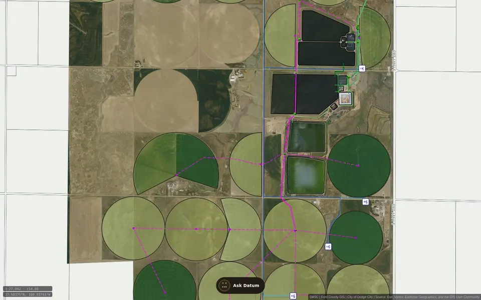
Datum utility map: irrigated fields and treatment ponds south of Dodge City with water and sewer lines drawn over aerial imageryMap

Public map · Dodge City & Ford County, Kansas

Datum — Utilities

A public, read-only reference map for Dodge City and Ford County. It organizes selected published water, sewer, well, hydrant, and related GIS layers for browsing and planning. Datum, the site assistant, can help visitors navigate the available map content.

Open
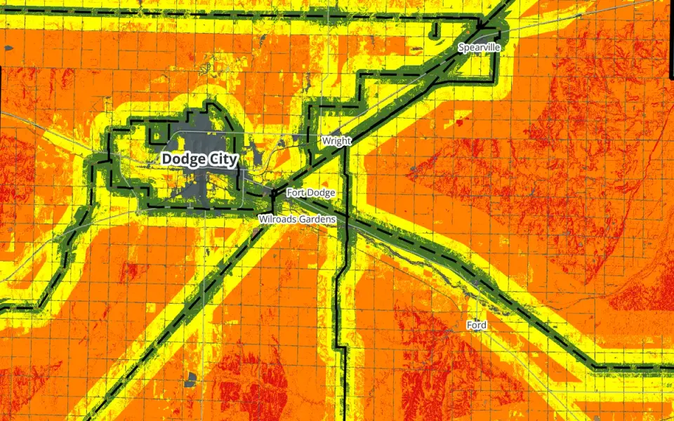
Baseline solar siting suitability map of Ford County: green high-suitability bands following transmission lines across orange and yellow farmlandResearch

Research · LRES 505 · Ford County, Kansas

Flat Out Suitable

A county-scale solar siting suitability study for Ford County. I weighted four factors, ran five weighting scenarios, and found that the answer depends heavily on transmission access.

Read
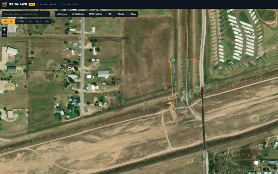
GridHawk mission planner: a survey grid drawn over aerial imagery with a flight-settings panelApp

Browser tool · drone mission planning

GridHawk

A browser-based mission planner for DJI Mini 4 Pro mapping flights. Define a survey area over imagery to generate a flight grid, camera-based spacing, altitude, overlap, and waypoints.

Open

Contact

Have a GIS, infrastructure, or research question?

↑↓ moveEnter openEsc close