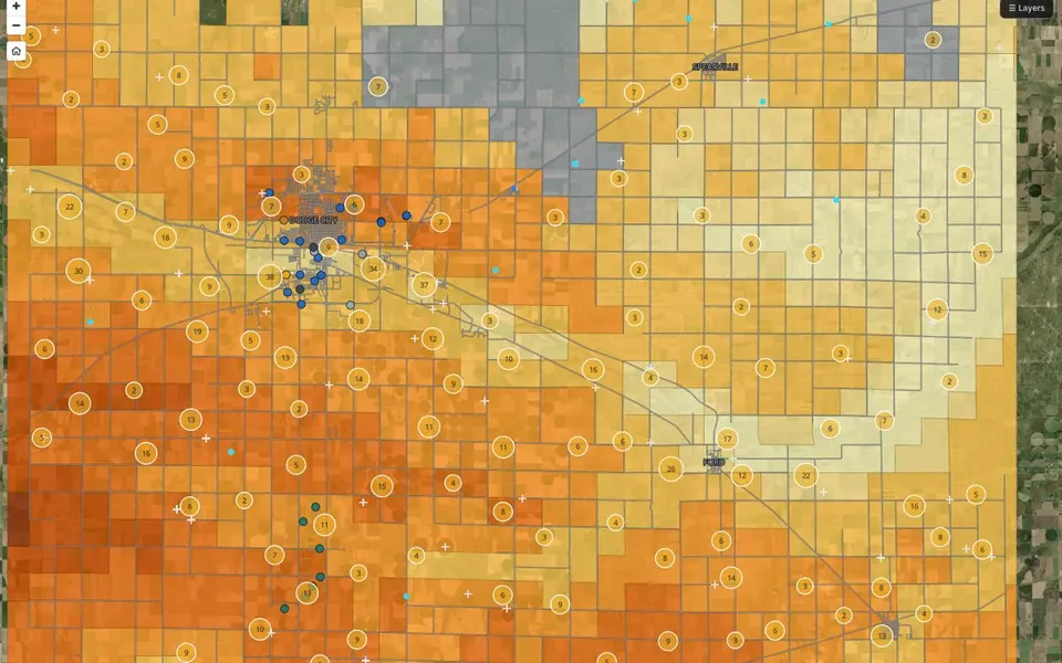
 Map
Depth to Water & Active Diversions
A public reference map of Ford County groundwater. It shows mapped depth-to-water ranges, active WIMAS diversion points, monitoring well references, and Dodge public-water wells.
Open
02 — Environmental GIS
I work on Ogallala Aquifer questions, land-use suitability analysis, and remote sensing and change detection. Most of it supports long-range decisions in a semi-arid region where water is the limiting factor.
Problems this addresses
Process
I start from public records such as elevation, land cover, wells, and diversions.
The layers go on one map with clear legends, units, and dates.
I run the weighted overlay, screening, and sensitivity tests, and I write the assumptions down.
I build teaching tools and plain-language summaries for people who do not use GIS.
Where this comes from. Four things on this site come from this work. They are the Ford County depth-to-water and active-diversions map, the Flat Out Suitable solar siting study, two teaching tools, and a capstone in development on stormwater capture and recharge feasibility.
Projects
Tools & methods
MapA public reference map of Ford County groundwater. It shows mapped depth-to-water ranges, active WIMAS diversion points, monitoring well references, and Dodge public-water wells.
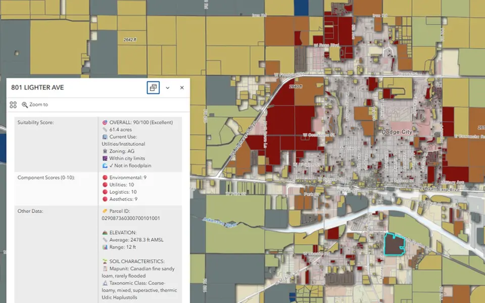 Map · external
An MCDA suitability score for residential parcels around Dodge City. Environmental constraints, utility access, logistics, and aesthetics are weighted into one score from 0 to 100 for each parcel.
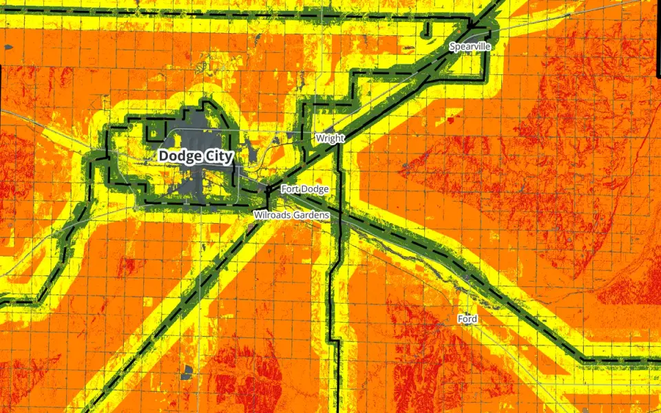 Research
A county-scale solar siting suitability study for Ford County. I weighted four factors, ran five weighting scenarios, and found that the answer depends heavily on transmission access.
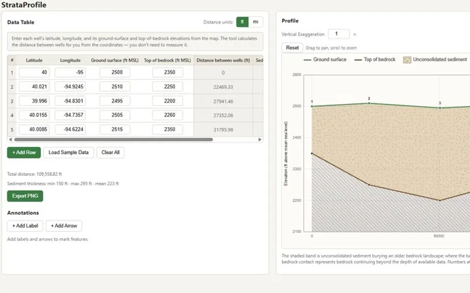 App
A browser tool that converts well-location and elevation records into a geologic cross-section. It calculates well spacing and sediment thickness while displaying the profile and source values together.
 App
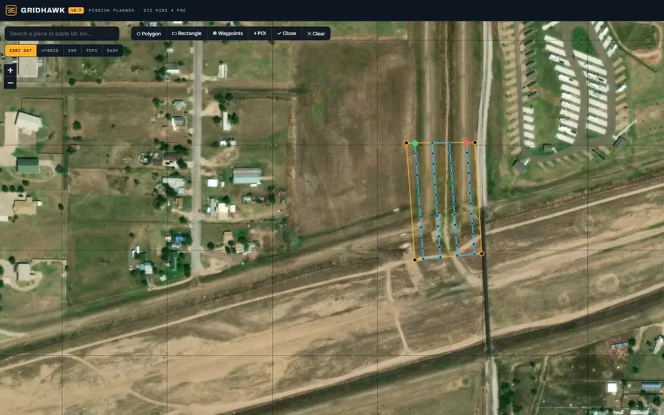
A browser-based mission planner for DJI Mini 4 Pro mapping flights. Define a survey area over imagery to generate a flight grid, camera-based spacing, altitude, overlap, and waypoints.
 App
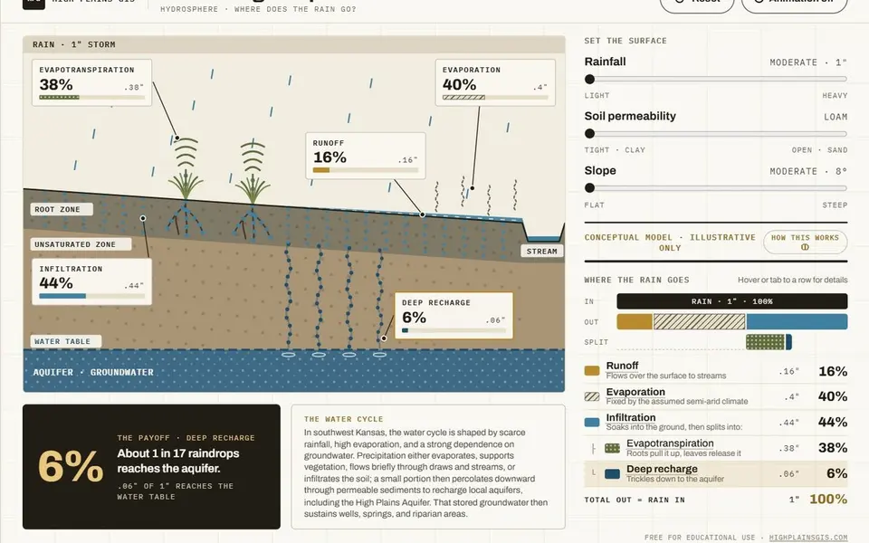
A conceptual hydrology teaching tool that shows how rainfall is partitioned among runoff, evaporation, and infiltration under different soil and slope conditions. It is an illustrative model, not a site-calibrated analysis.
 Research
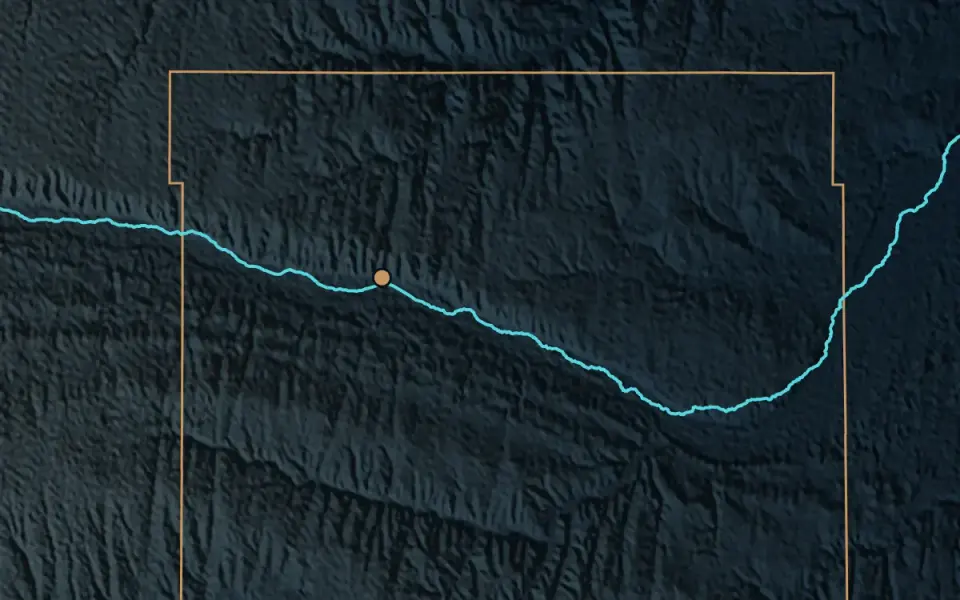
Dodge City routes stormwater to the Arkansas River while the Ogallala Aquifer remains under pressure. My capstone asks whether a portion of that runoff could be captured, retained locally, and routed by gravity to locations suitable for further recharge evaluation.
Contact