03 — Economic GIS

Decision support and suitability analysis.

I build present-worth cost-benefit comparisons and MCDA suitability models. The output is a score, a map, and a short written finding that a board can question and still act on.

Baseline weights from the Ford County solar study: transmission 40 percent, land cover 25, slope 20, roads 15 Transmission40%Land cover25%Slope20%Roads15% Baseline weights · Flat Out Suitable
Actual baseline weights from the LRES 505 solar study

Problems this addresses

  • A board needs a recommendation. A list of layers does not help it.
  • Every weighting scheme contains a value judgment, and that judgment should be visible.
  • Costs fall in different years, so they have to be compared on the same basis.
  • A map has to hold up when someone asks a hard question about it.

Process

From criteria to a decision.

  1. Criteria

    I name the factors that drive the decision and say where their data comes from.

  2. Weights

    I assign the weights in the open and say why.

  3. Sensitivity

    I change the weights and see what moves. If the answer flips, I say so.

  4. Decision output

    The result is a set of classes, scores, and a short written finding that a board can act on.

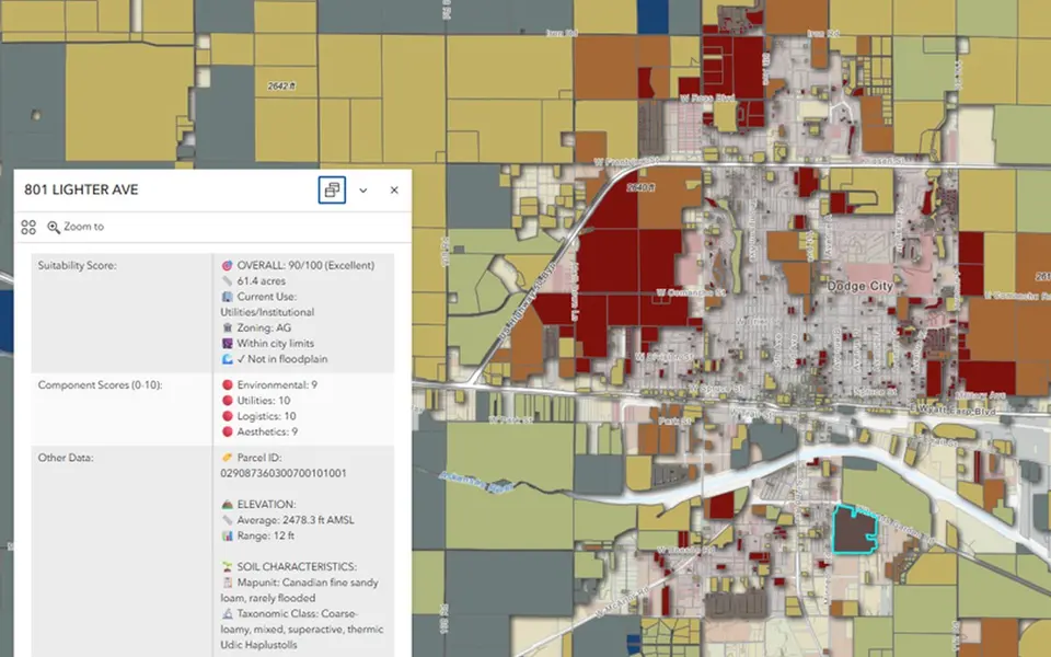
Where this comes from. Two projects on this site come from this work. The Flat Out Suitable study uses four weighted factors and five scenarios. The residential parcel suitability map combines environmental, utility, logistics, and aesthetic scores into one 0–100 score per parcel. I also do present-worth cost-benefit work, but I have not published a financial model here, so none is shown.

Projects

Economic GIS on this site.

Tools & methods

  • Multi-criteria decision analysis
  • Weighted overlay
  • Sensitivity analysis
  • Present-worth comparison
  • ArcGIS Experience Builder
Residential parcel suitability map of Dodge City with a parcel popup showing an overall score and component scoresMap · external

External · ArcGIS Online · Ford County, Kansas

Residential Parcel Suitability (opens ArcGIS Online in a new tab)

An MCDA suitability score for residential parcels around Dodge City. Environmental constraints, utility access, logistics, and aesthetics are weighted into one score from 0 to 100 for each parcel.

Open in ArcGIS
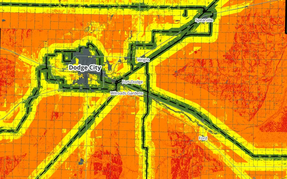
Baseline solar siting suitability map of Ford County: green high-suitability bands following transmission lines across orange and yellow farmlandResearch

Research · LRES 505 · Ford County, Kansas

Flat Out Suitable

A county-scale solar siting suitability study for Ford County. I weighted four factors, ran five weighting scenarios, and found that the answer depends heavily on transmission access.

Read

Utility GIS Environmental GIS

Contact

Have a GIS, infrastructure, or research question?

↑↓ moveEnter openEsc close